Not only does the DOT equip its snowploughs with GPS, but also brings together information from sensors that detect the operation of the truck’s salt spreader, plough position, and engine status, along with forward-facing cameras mounted on the trucks. In addition, each plough is equipped with infrared sensors to record surface temperature on the roadway. This, along with data from a network of 75 weather stations at key locations on the road network, helps track the pavement temperatures at different depths, as well as the temperature of bridge decks. This information is fed back to a central winter operations command centre, where it is displayed in their Esri-based geographic information system (GIS), allowing the maintenance staff greater visibility and control of their snow operations.
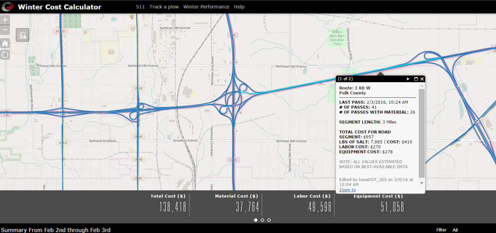
In turn, this information is served back out to the public, giving them a real-time understanding of current conditions, and help to make better driving choices. But Iowa DOT takes this visibility one step further and also provides a view of the cost to keep the roadways clear, section by section. Through a series of Esri-based GIS dashboards, the public has a comprehensive view of the department’s winter operations. As John Selmer, the director of strategic performance said, “Giving the public an understanding of the cost of a storm allows us to have more meaningful discussions. We can create a better dialogue about levels of service and what it takes to keep the roads clear.”


")


")