
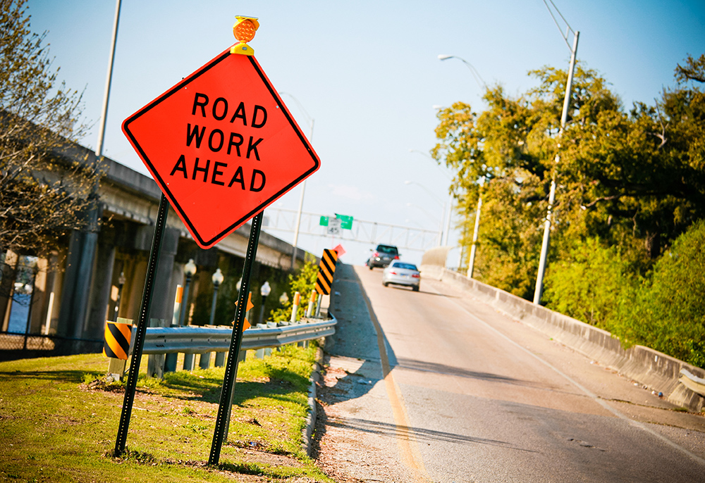
From 1982 through 2017, 27,037 individuals or approximately 773 people per year, lost their lives in US workzones. In 2019, that number reached 842. The people we charge with building, maintaining and keeping our roads safe, are dying at an alarming rate.
Unfortunately, it’s physics. Whenever you put a 180-pound worker with a shovel in an environment intended for a 4,000-pound vehicle with wheels, it creates risk and the potential for tragedy. Those tragedies play out almost every day in America. I challenge you right now to go ahead and search “workzone fatal crash” on Google News, and you’ll find a parade of stories documenting horrific crashes and identifying the people who never made it home to their families. It would be morose and perhaps self-defeating to list all those names here, but those victims make a better case than I ever could for more investment and increased commitment for protecting crews and drivers in workzones.
Limiting tragedies
None of that is to malign what has come before. Workzone safety awareness campaigns and significant advances in technology have done amazing things to keep workers safe, but I believe there’s always more we can do to lower the risk and limit the tragedies.
In my leadership role at One.network, I’ve seen a single idea validated time and time again – that in road management, accurate and timely information is key to efficiency and most importantly, safety. That’s why our company is committed to sharing workzone and lane-closure information with agencies, the public and frankly, anyone who will listen. If you’re not familiar with us, One.network provides a platform to give agencies, the media and the public, the clearest real-time picture of workzones, lane closures, planned events and incidents on the roadway. That’s why we became involved in, and committed to, a major work zone safety initiative spearheaded by the Federal Highways Administration (FHWA).
FHWA has launched a nationwide effort to share workzone data across all 50 states. It’s called the Work Zone Data Exchange or WZDx and it was designed by some of the smartest minds at FHWA, the ITS Joint Program Office, the Bureau of Transportation Statistics and the Federal Motor Carrier Safety Administration along with private-sector partners including some of us at One.network. Borrowing from the US Department of Transportation (USDoT) website: “The WZDx Specification enables infrastructure owners and operators to make harmonised workzone data available for third-party use. The intent is to make travel on public roads safer and more efficient through ubiquitous access to data on workzone activity. Specifically, the project aims to get data on workzones into vehicles to help automated driving systems and human drivers navigate more safely.”
Limitless scenarios
Nobody can argue with the nobility of the cause, and it will surprise exactly no one if I acknowledge the huge differences between agencies, not just in terms of organisational structure, but also in approach. Some use advanced ITS networks to warn about roadway incursions. Others, fighting a tide of budget and workforce constraints, are forced to develop other more traditional strategies. Regardless, it’s clear that the goal of creating a national repository where anyone can access data could have a profound impact on safety and efficiency in almost limitless scenarios. Imagine an agency having access to real-time data as a work project progresses down a street. Imagine a driver having access to current workzone and lane-closure information across jurisdictions, because (spoiler alert) trips often transition across city boundaries. At its best, road efficiency is contingent on the idea that we harness the power of technology to maximise traffic flow. The adage that “we can’t build our way out of gridlock” has become a traffic management cliché in the last few years - but like most cliches, it’s rooted in truth. That’s where WZDx comes in.
WZDx has the potential to unify, standardise and share workzone information in a simple yet completely unprecedented way. It not only involves collating and sharing data across often siloed DoT sources, but also through navigation apps, including Google, Waze and TomTom. In other words, it provides crucial information in the venues most drivers go to first.
This is a perfect example of more information providing greater awareness and more awareness providing increased safety, but I’m also excited that USDoT has positioned the effort as part of the road toward fully-connected and even autonomous vehicles. In 2021, data streams that provide valuable, actionable safety information inside the cockpit are no longer a luxury. They’re an expectation, and they’re fast becoming a necessity. Just as adaptive cruise control and lane-departure warnings made dramatic safety impacts in the recent past, WZDx isn’t just about catching up, it’s about leaping ahead.
Unique problem
I’m acutely aware that workzone safety isn’t just an American problem, but I do believe the problem in the US is unique and deserves to be treated that way. In England, where I was raised, the country’s population is just over 56 million, well less than the combined populations of California and New York. England occupies less space than the state of Florida and while I’m proud of the many things we’ve done to advance nationally-coordinated and collaborative traffic management, it’s not an apples-to-apples comparison. It’s more like apples to alligators. America’s massive variations in terrain, climate, topography and urban-versus-rural landscapes create challenges on a scale my English friends just don’t have to consider. In the US, it’s just more complicated. The government relationships are much more nuanced, the regional funding models are unique, and priorities and mandates differ. That’s why we’re committed to helping develop solutions that recognise geographic obstacles, yet standardise workzone safety; solutions like WZDx.
In an announcement in August 2020, FHWA offered almost $2.4m in demonstration grants to fund projects in 13 states, but for other agencies or operators with limited resources, there’s the reality that they might struggle to commit to developing their own WZDx feeds amid a litany of competing priorities. I completely understand that. Even with the promise of the recently-passed US Infrastructure bill, agencies will always have to struggle with the uncomfortable choice of which valuable programmes to fund at the cost of other valuable programmes.
We can help. I want to assure you, this isn’t a thinly-veiled pitch for One.network. We’re confident that sales of our “paid” solution will continue to happen organically. Rather, it’s our discovery that with minor modifications, our workzone, lane-closure and event-planning software already has the capability to create FHWA WZDx-compliant feeds, and we’re prepared to set up a free feed with no asterisks, for any agency that asks.
Right side of history
One populous state with varied, unique challenges has already taken us up on our offer and we’ll share those details as soon as the state DoT gives us the go-ahead to discuss it publicly. We are currently talking with other states, and I assure you, this offer is sincere and made for the right reasons. It’s a ‘right side of history’ argument and it’s captured in a very visual representation of the issue.
The National Work Zone Memorial is a travelling wall that documents the names of those killed in workzone crashes. It is curated by the American Traffic Safety Services Foundation and each year, in a sad ritual, new names are added. The wall travels around the nation and often appears at transportation safety events. If you happen to see it, walk close and look over some of the names, then recognise that each name on the wall represents the worst day in the lives of a family - names like Jeffrey Wayne Arbogast of Olds, Iowa, Kathryn Houck of Allegheny County, North Carolina, and Mark Pirelli of Wyanet, Illinois.
 As industry leaders we share an obligation to them, but we’re also blessed with the opportunity and capability to improve the future. Transportation and traffic management are evolving at an incredible pace, but I always return to that one idea: whether we’re talking about a Level 5 autonomous vehicle, a signal network or a rapidly changing workzone, accurate and timely information will always be at the core.
ABOUT THE AUTHOR:
Simon Topp is chief commercial officer of One.network

")
")
")