
Lane closures happen overnight and must be clear by 7am
When Texas A&M Transportation Institute was asked to devise a temporary traveller information system for work zones, it started by asking drivers what they need. Robert Brydia explains the thinking, implementation and results.
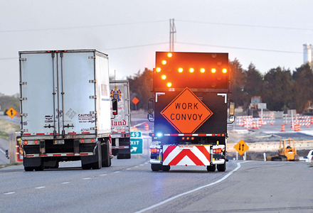
US Interstate 35 (I-35) runs roughly north–south originating in Laredo, Texas and ends 1,500 miles away in Duluth, Minnesota having passed through Oklahoma, Kansas, Missouri and Iowa. Within Texas the I-35 splits into I-35E and I-35W passing through Dallas and Fort Worth respectively, before rejoining into a single highway to the Oklahoma border. Nicknamed ‘Main Street Texas’, 45% of Texans live within 80km (50 miles) of the I-35 and this portion of the road carries more than 100,000 vehicles per day with two-thirds being through traffic. Between 25 and 30% of the vehicles are trucks and at night this proportion can rise to 75% and more. As the lane closures are only permitted overnight from 7pm (10pm on Sundays) and must be clear by 7am, truck traffic is disproportionately disadvantaged.
The375 Texas Department of Transportation (TxDOT) is currently undertaking a $2 billion reconstruction of nearly 160km (100 miles) of the central Texas portion of the I-35. This will see the roadway expanded from four lanes to six in rural areas and to eight lanes in urban areas with continuous one-way feeder or frontage roads. Construction is expected to be substantially complete by 2015 in the rural areas and 2017 in the townships.
TxDOT is using an advanced construction traveller information system to keep the public informed and enhance safety and mobility during the multiple years of construction. The Texas A&M Transportation Institute (TTI) was contracted to collaborate with the Waco District in developing and implementing the construction traveller information system for the I-35 corridor.
To meet this requirement TTI devised a user survey and comprehensive systems engineering process to determine travellers’ information needs to form the foundation for the planning, design and deployment of system capabilities to fulfil those needs.
The primary objectives of the survey were to establish the types of traveller information motorists considered most useful, when travellers wish to receive travel information and methods motorists typically use to obtain that information.
Almost 900 respondents completed the 16-question survey – more than half which drove the corridor I-35 more than once per week and were aware of the impending construction work. Three-quarters drove on the I-35 at least once every three months and roughly half of respondents’ journeys were for business.
Respondents were asked to rank their information needs from one (most desired) to eight (least desired) and the weighted results are summarised in the table below.
A set of user needs were identified for each of the three major traveller groups: local, corridor and commercial. In aggregate, those user needs are:
• Provide for travel time monitoring and forecasting of travel conditions along the affected section of the I-35 and selected alternative routes.
• Provide projected queue lengths and delay times for planned lane closures in the construction zones.
• Provide advance end-of-queue notification and real-time safety monitoring of the multiple planned lane closures in the construction zones.
• Provide for the real-time monitoring and travel time information for a pre-trip traveller information service to help travellers with route choices. Deliver en route traveller information with updated travel time and route delay information.
• The information is shared with the existing traffic management centres in order that it is available to as many travellers as possible.
Additional needs were identified for other user groups including the emergency services, schools, businesses, TxDOT and contractors. Many related to the coordination necessary for interactions between contractors on different jobs, ensuring schools and emergency response services have current access route information and businesses are given advanced warning of closures affecting their location. Various radio and television stations, newspapers and websites also provide important channels to disseminate the construction information.
Bluetooth travel time monitoring was initially deployed to prove the concept and this was followed by full deployment throughout the work zone and provided the ability to implement en route travel times using portable changeable message signs (PCMS). There are 40 individual Bluetooth reader segments each between 1.6 and 5km (one and three miles) in length and the sensors are bi-directional. The results from the individual sections are aggregated into a longer distance travel time segments as drivers are more concerned about travel times for the next 24 - 32km (15 - 20 miles) rather than the next kilometer or so. The result is that drivers get 10 or 11 travel time destinations in each direction.
Work on defining and installing a traveller information system began shortly after road work started in some sections of the corridor. The first beneficiaries started receiving email notifications of lane closures in May 2012 and shortly afterwards the variable message signs were installed to show travel time to the next destination. CCTV cameras were then installed to aid in incident detection and verification while counting stations now provide current and historical volume data to enhance the lane closure assessment which was initially based on 2009 data.
Web-based real-time traveller information (travel time and lane closures) was the next improvement and coincided with automated social media distribution. Deployments to obtain current information about traffic volume also allowed TxDOT to start forecasting delays and deploy an end-of-queue warning system. This uses a combination of speed sensors and local message signs which are deployed at night if the projected impacts show the potential for queue formation. To date, more than 120 closures have been protected with this system and a study is underway to determine the benefits of the system for possible state-wide deployment.
Data collected during lane closures are used for post-closure analysis and is compared with the predicted delay times/queue lengths in order to further refine the prediction model. Using the Bluetooth information, the total delay associated with a closure is calculated and is routinely examined to continuously improve the lane closure process.
Early in the project the goal was set to keep delays to less than 30 minutes and in nearly 500 lane closures year-to-date, (20% of which were high impact), this target has only been exceeded 3% of the time.
The travel information system will continue to be enhanced. The real-time map is to get a trip planning tool allowing the traveller to identify only the closures affecting their trip, show travel times for their route and forecast journey time by starting point and time of day.
A forecasted corridor delay capability is under development, which will display the delay that travellers will experience later in their trip on variable message signs. The display is updated every five minutes using current travel times, volumes and end-of-queue information.
Each capability is backed by systems engineering analysis to detail how the information system would function under different events, or use cases. For system designers, this provides an understanding of how the system will collect and process data; provide decision support and traveller information, and potentially impact operations given certain events in the corridor.
Information desired by I-35 travellers
Robert Brydia is a research scientist at Texas A&M Transportation Institute and the principal investigator and corresponding author for the $12.3m project to design, develop, build, operate and maintain the temporary traveler information system throughout the I-35 upgrade.
US Interstate 35 (I-35) runs roughly north–south originating in Laredo, Texas and ends 1,500 miles away in Duluth, Minnesota having passed through Oklahoma, Kansas, Missouri and Iowa. Within Texas the I-35 splits into I-35E and I-35W passing through Dallas and Fort Worth respectively, before rejoining into a single highway to the Oklahoma border. Nicknamed ‘Main Street Texas’, 45% of Texans live within 80km (50 miles) of the I-35 and this portion of the road carries more than 100,000 vehicles per day with two-thirds being through traffic. Between 25 and 30% of the vehicles are trucks and at night this proportion can rise to 75% and more. As the lane closures are only permitted overnight from 7pm (10pm on Sundays) and must be clear by 7am, truck traffic is disproportionately disadvantaged.
The
TxDOT is using an advanced construction traveller information system to keep the public informed and enhance safety and mobility during the multiple years of construction. The Texas A&M Transportation Institute (TTI) was contracted to collaborate with the Waco District in developing and implementing the construction traveller information system for the I-35 corridor.
Identifying traveller desires
While the infrastructure will eventually have permanent ITS, the majority of these resources will not be available until the road is almost finished. However, during the construction phase TxDOT wanted to convey a complex set of information to travellers, including travel times, speeds, delays, lane closures and local safety information.To meet this requirement TTI devised a user survey and comprehensive systems engineering process to determine travellers’ information needs to form the foundation for the planning, design and deployment of system capabilities to fulfil those needs.
The primary objectives of the survey were to establish the types of traveller information motorists considered most useful, when travellers wish to receive travel information and methods motorists typically use to obtain that information.
Almost 900 respondents completed the 16-question survey – more than half which drove the corridor I-35 more than once per week and were aware of the impending construction work. Three-quarters drove on the I-35 at least once every three months and roughly half of respondents’ journeys were for business.
Respondents were asked to rank their information needs from one (most desired) to eight (least desired) and the weighted results are summarised in the table below.
Identifying user needs
Based on the survey results, the project team designed, developed and deployed an advanced construction traveller information system. The word ‘construction’ is vital as it recognises that this is not a typical traffic management centre as its primary focus is not on incident management detection and mitigation.A set of user needs were identified for each of the three major traveller groups: local, corridor and commercial. In aggregate, those user needs are:
• Provide for travel time monitoring and forecasting of travel conditions along the affected section of the I-35 and selected alternative routes.
• Provide projected queue lengths and delay times for planned lane closures in the construction zones.
• Provide advance end-of-queue notification and real-time safety monitoring of the multiple planned lane closures in the construction zones.
• Provide for the real-time monitoring and travel time information for a pre-trip traveller information service to help travellers with route choices. Deliver en route traveller information with updated travel time and route delay information.
• The information is shared with the existing traffic management centres in order that it is available to as many travellers as possible.
Additional needs were identified for other user groups including the emergency services, schools, businesses, TxDOT and contractors. Many related to the coordination necessary for interactions between contractors on different jobs, ensuring schools and emergency response services have current access route information and businesses are given advanced warning of closures affecting their location. Various radio and television stations, newspapers and websites also provide important channels to disseminate the construction information.
System capabilities
A comprehensive set of system components have been designed and are either operational or planned. The first to be operational was a comprehensive lane closure database as it is key to centralising information across the 17 projects on the corridor. This was followed by a daily email distribution of upcoming lane closures with further updates if closure conditions changed. Separate emails giving a seven-day forecast or high-impact notices (closing one direction of the freeway) were added later.Bluetooth travel time monitoring was initially deployed to prove the concept and this was followed by full deployment throughout the work zone and provided the ability to implement en route travel times using portable changeable message signs (PCMS). There are 40 individual Bluetooth reader segments each between 1.6 and 5km (one and three miles) in length and the sensors are bi-directional. The results from the individual sections are aggregated into a longer distance travel time segments as drivers are more concerned about travel times for the next 24 - 32km (15 - 20 miles) rather than the next kilometer or so. The result is that drivers get 10 or 11 travel time destinations in each direction.
Work on defining and installing a traveller information system began shortly after road work started in some sections of the corridor. The first beneficiaries started receiving email notifications of lane closures in May 2012 and shortly afterwards the variable message signs were installed to show travel time to the next destination. CCTV cameras were then installed to aid in incident detection and verification while counting stations now provide current and historical volume data to enhance the lane closure assessment which was initially based on 2009 data.
Web-based real-time traveller information (travel time and lane closures) was the next improvement and coincided with automated social media distribution. Deployments to obtain current information about traffic volume also allowed TxDOT to start forecasting delays and deploy an end-of-queue warning system. This uses a combination of speed sensors and local message signs which are deployed at night if the projected impacts show the potential for queue formation. To date, more than 120 closures have been protected with this system and a study is underway to determine the benefits of the system for possible state-wide deployment.
Data collected during lane closures are used for post-closure analysis and is compared with the predicted delay times/queue lengths in order to further refine the prediction model. Using the Bluetooth information, the total delay associated with a closure is calculated and is routinely examined to continuously improve the lane closure process.
Early in the project the goal was set to keep delays to less than 30 minutes and in nearly 500 lane closures year-to-date, (20% of which were high impact), this target has only been exceeded 3% of the time.
The travel information system will continue to be enhanced. The real-time map is to get a trip planning tool allowing the traveller to identify only the closures affecting their trip, show travel times for their route and forecast journey time by starting point and time of day.
A forecasted corridor delay capability is under development, which will display the delay that travellers will experience later in their trip on variable message signs. The display is updated every five minutes using current travel times, volumes and end-of-queue information.
Each capability is backed by systems engineering analysis to detail how the information system would function under different events, or use cases. For system designers, this provides an understanding of how the system will collect and process data; provide decision support and traveller information, and potentially impact operations given certain events in the corridor.
| Desired Information | Weighted Average |
|---|---|
| Expected delays between major points along I-35 | 3.28 |
| Current travel times between major points along I-35 | 3.65 |
| Current locations of incidents | 3.71 |
| Locations and times of freeway lane closures | 4.07 |
| Projected travel times between major points along I-35 | 4.70 |
| Current speeds on each segment of I-35 | 5.15 |
| Detour routes/maps | 5.29 |
| Snapshots of freeway conditions at selected points along I-35 | 6.15 |
Information desired by I-35 travellers
Robert Brydia is a research scientist at Texas A&M Transportation Institute and the principal investigator and corresponding author for the $12.3m project to design, develop, build, operate and maintain the temporary traveler information system throughout the I-35 upgrade.


")
")
")
")
")
")

")
")
")