")
The perceived safety benefits of autonomous vehicles can only be realised with precise positioning. Ben Spencer reports from Sweden on work by a European consortium which aims to use the technology to allow a truck to carry out an automated lane change
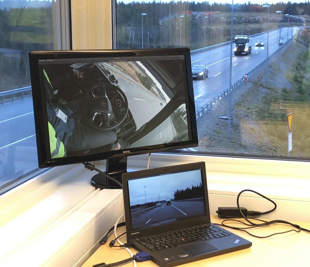
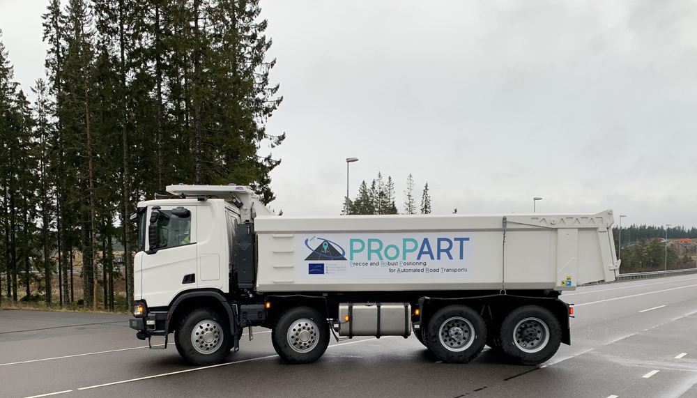
A European consortium has developed a positioning solution which could help autonomous vehicles improve road safety and efficiency. ProPart (Precise and Robust Positioning for Automated Road Transports) is demonstrating how a Scania truck can use this technology to carry out an automated lane change in the Swedish city of Borås.
ProPart’s seven partners have developed and enhanced Waysure’s existing RTK (real-time kinematic) solution by utilising features of Galileo satellite signals, while combining it with other positioning and sensor technologies as part of a 24-month Horizon 2020 project.
RTK is a technique used for GNSS (global navigation satellite system)-positioning based on the use of the code- and carrier-phase measurements from the primary GNSS constellations. The use of carrier phase measurements is expected to allow centimetre-level accuracies at the expense of having to solve the integer ambiguity of the carrier signals. The initiative – funded by the European Global Navigation Satellite System Agency (GSA) – also utilised an ultra-wideband (UWB) ranging solution provided by Spanish research institution Ceit-IK4 for areas with low GNSS signals.
Safe decision
Speaking at the AstraZero proving ground in Sweden, Stefan Nord, senior research project manager for ProPart’s validation partner RISE, says information from on-board sensors, sensors on the road and a traffic-monitoring radar fuse together for the truck “to make a safe decision to change lanes”.
However, trucks present more challenges than cars and must be positioned in every part of their extremity, states Waysure’s CEO James Tidd.
“On average, trucks are 2.55m wide compared to cars which are usually 1.8m,” he says. “Unfortunately, lanes do not get any wider just because you’re bigger, so the need for accuracy is greater because you have less distance to move or be wrong before exiting the lane.”
Tidd explains that the ProPart Positioning Manager integrates all the motion and positions information to a single point.
A truck’s point of rotation also means that the route travelled by the front of the truck is not necessarily the same as the route at the back of the vehicle – this is the problem which can cause so-called ‘bendy buses’, for instance, to catch a kerb.
“The ProPart Positioning Manager is the chef that mixes the ingredients and delivers the cake,” he beams. “Absolute positioning is key here and it needs to be understandable by other vehicles and relatable to a map which is often a global reference frame.”
Single point
The solution runs on Fraunhofer IIS’s (Institute for Integrated Circuits) GOOSE (GNSS receiver with open-software interface) platform and uses a positioning technique via a fused RTK solution, which involves ultrawide band IMU (inertial measurement unit) data, odometry and GNSS signals. A second method includes a deeply-coupled tracker - an IMU partnered with GNSS signals to provide robust high availability.
“In this unit, the GOOSE platform is where GNSS signals are correlated and tracked and where the deeply-coupled tracking solution is implemented,” Tidd adds. “It’s also where the complete fusion of ultrawide band, odometry, IMU and GNSS is made for the RTK solution.”
He emphasises that these components need to be brought to a single point, but recognises that there is a large distance between the GNSS antenna and reference point.
“The truck’s cab will rock backward and forward, which means that translating 2cm accuracy from the antenna to another part of the vehicle is nigh on impossible and you will incur errors,” Tidd warns.
He describes the DDKF (Double Difference-Kalman Filter) subsystem as the ‘mixing pot’ where the ‘chef’ takes all the ingredients from the different sensors and weighs them to provide a “positioning velocity attitude solution” for the rest of the system. Results showed the performance from the DDKF and RTK solution offer a time to reacquisition of three to 10 seconds.
“If we lose signals for a short period, we can reacquire almost instantaneously,” he reveals. “The initialisation process can be done under motion for this multi-frequency, high-accuracy code technique.”
Scania demo
For the demonstration, Scania’s truck operated on a highway in scenarios with two manually driven cars.
Fredrik Hoxell, online location intelligence at Scania, says the truck can change lanes when there is no car approaching from behind or moving more slowly in front.
In the first test scenario, Hoxell explains that the truck will travel at a lower speed behind the car and must wait for it to move out the way.
“The system should initially conclude that the lane change cannot be performed. Once the obstacle car has moved out of the way, the system should identify that this free space has opened up and we should be able to change the lane,” he adds.
A second scenario has all vehicles travelling at the same speed, allowing enough distance for the merge to take place.
The truck has an on-board safety driver as well as two side-looking radars, on-board sensors and a smart camera. It also comes with high-resolution odometry and driveshaft direction of rotation to know which direction it is travelling in.
Hoxell reveals that the perception lane availability is handled by the ProPart local dynamic map layer which feeds information to the decision-making algorithm.
“The local dynamic map layer will indicate when it’s safe to change lane and that you won’t kill anyone,” he continues. “We updated the side target posts, so we actually would feed a new assignment to the vehicle that will trigger a replan of the trajectory that will execute the resulting plan.”
Communication hub
Within the project, Commsignia began prototyping Day 2 features such as RTCM (radio technical commission for maritime services) for correction data and CPM (collective perception message) for free space and object distribution.The company’s Vehicle to Everything (V2X) units served as the central communication hub. Information collected from external equipment is fused within three roadside units (RSUs) to transfer them into different V2X services.
András Váradi, research programme director at Commsignia, told the audience in Sweden that the company set out to share information on a roadside sensor on confirmed free space.
“We needed to define how to extract free space information so that the sensor can be sure of the emptiness instead of being sure of an object,” he divulges. “We also need to establish how to grab this information and enhance CPM to be able to broadcast this along with the properties in the requirements.”
A CPM module has information on the type and sensor being used by the sender and its area of detection to detect which areas to expect objects. A second container is used for objects which are already there, allowing them to be defined within the sensor detection area.
“Within the detection area you can define free space. The distribution is between one and 10 hertz, so its relatively fast,” Váradi reveals.
Commsignia also used an “overlapping service” for UWB status which helps improve the reliability of the system.
“We are using GOOSE to get the correction service and we adding Day 2 services along with the RTCM. The attached UWB node on the roadside provides the UWB status and the radar allows CPMS to be generated,” Váradi summarises.
Surrounding environment
German software firm Baselabs offered a unified representation of the environment around the vehicle by fusing data from the truck’s sensors with three radars on the RSUs. It developed an environmental model to provide information on the environment, which is then used by the situation assessment model to determine whether a lane change is possible.
Liang Zhang, research programme director at Baselabs, says the environmental model takes input from the truck’s on-board sensors, the traffic sensors mounted on Commsignia’s RSU and the ProPart Positioning Manager to provide an estimation of dynamic object states and the static free space.
“The situation assessment then assesses if it is possible and safe to perform a lane change, and a positive decision will trigger an automated lane change which is realised by Scania,” he adds.
While positioning trucks may prove more challenging than cars, the ProPart project shows that collaboration could help overcome obstacles surrounding AVs - while also fulfilling the different needs of vehicle OEMs.
Fraunhofer’s GOOSE platform
Fraunhofer developed the GOOSE platform to provide access to standardised and specific raw data to enable the construction of GNSS receivers that overcome the limitations of existing receivers - which can be used in a range of dedicated applications.
Matthias Overbeck, group manager precise GNSS at Fraunhofer, explains that GOOSE uses Galileo time as its reference.
“We made this configurable so that users can decide the time and system the GNSS receiver is synchronised,” he continues. “Galileo time is then distributed to the subsystems of the ProPart project through precision time protocol.”
GOOSE uses the E1B, E5A and E5 AltBOC signal, which is robust against multi-paths such as reflections from buildings. Galileo comes with open service navigation message authentication (OS-NMA), which is expected to allow users to verify that a navigation message comes from a Galileo satellite and not a potentially malicious source.
")
")
")
")
")
")

")
")
")