
Figure 1: Sheridan mesocopic model network. The area inside the blue polygon is the microsimulation area of the hybrid model; Sheridan Expressway is highlighted in red
Michael Marsico, Andrew Weeks, Keir Opie and Murat Ayçin explain the application of hybrid traffic simulation to a planning study in New York City.
Traffic modelling, particularly mesoscopic-microscopic hybrid simulation, has played a key role in planning for the future of one of America's shortest interstates, the 1.3-mile Sheridan Expressway.
New York City has just completed a two-year, interagency study federally funded by a TIGER II grant on how to improve the Sheridan Expressway and its surrounding infrastructure. The interagency study team had to balance the community priorities of an increasingly vibrant residential area against the need to maintain efficient routes to Hunts Point, the economic and employment core of the area. The study also addressed issues such as better public access to parks along the Bronx River, improved safety for pedestrians and cyclists, and rationalizing the highway network.
The findings of the study, announced in summer 2013, are a set of recommendations for direct access ramps to the industrial area of Hunts Point—which will keep trucks from using local streets and help promote job growth—and for transforming the northern half of the Sheridan Expressway into a local boulevard with a green waterfront, crosswalks and traffic signals. The proposed changes would greatly reduce the footprint and impact of the expressway on local neighbourhoods.
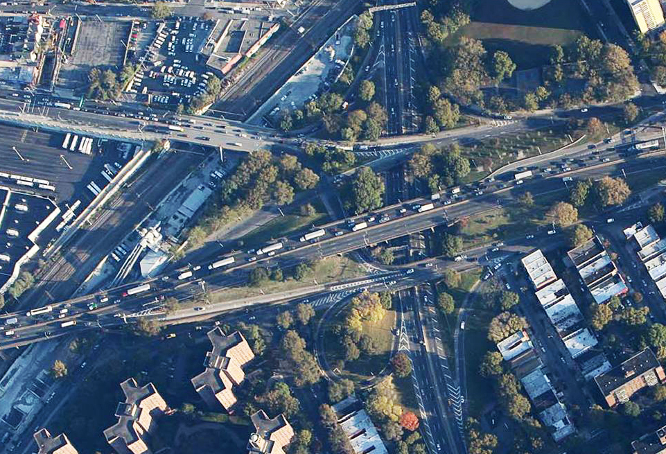
Approximately 53,000 vehicles use the Sheridan Expressway between the Cross Bronx Expressway and Westchester Avenue every day. To put this into perspective, the bottleneck on the Bruckner Expressway and Boulevard at the Sheridan Expressway affects approximately 140,000 vehicles daily with the highest single-hour volume – approximately 2,500 vehicles – occurring in the morning on the three-lane southbound section of the expressway before the Westchester Avenue exit.
5590 New York City Department of Transportation (NYCDOT) commissioned STV Inc., 5673 Cambridge Systematics and TSS-2195 Transport Simulation Systems to develop and calibrate both a mesoscopic model and a hybrid model of the wider area.
In adopting a two-pronged approach, NYCDOT sought to accomplish two objectives: to evaluate the impact of the proposed changes with a high degree of confidence and to compare the two techniques with an eye on future, large-scale applications.
STV Inc. and Cambridge Systematics developed the Sheridan Expressway mesoscopic model as a wide sub-area extraction from the larger area Manhattan Traffic Model (MTM) with added details and highway extensions in the Bronx. Underlying travel demand patterns and growth forecasts were extracted from the New York Best Practices Model (NYBPM) of the New York Metropolitan Transportation Council (NYMTC’s), the Metropolitan Planning Organisation for the New York City region. In addition to evaluating scenarios at the mesoscopic level, the team applied a hybrid modelling approach to further assess changes in traffic patterns along alternative routes, especially in the vicinity of Sheridan Expressway and the Hunts Point peninsula. This allowed the team to study certain critical locations, such as complex merge and weaving segments, in microscopic detail within a larger mesoscopic model.
First, the team developed and calibrated a mesoscopic model applying Dynamic Traffic Assignment (DTA) according to the Dynamic User Equilibrium (DUE) principle. Then the modellers selected any areas that required microscopic detail and ran the hybrid model.
Microscopic traffic simulation models the movement decisions of each vehicle inside a traffic network in every time step - typically every fraction of a second.
These systems are capable of modelling complex interactions between public and private vehicles, or between vehicles and pedestrians. Their disaggregate nature allows them to realistically represent a variety of complex operational conditions
although they require some effort to put together and calibrate.
Prior to the advent of hybrid simulation, when a micro-simulation of a smaller area was desired, a sub-area needed to be extracted from a larger mesoscopic model. This process of using matrix traversal methods to obtain a new set of origin-destination matrices for the smaller area decoupled the smaller microscopic simulation area from the larger mesoscopic model. In addition, whenever the micro-simulation of other areas was needed, several microscopic models needed to be extracted adding maintenance overhead and further inconsistency. So although macroscopic, mesoscopic and microscopic models would all be based on the same network, each sub-area used separate traversal trip tables.
The significant downside was that, even if changes in sub-areas dramatically affected travel times on some links, the effect of changes on trips originating and ending outside the sub-area was not taken into account. This is a recipe for overestimating the local merits of a scheme at the potential expense of congestion outside the sub-area to which it is applied.
By contrast, in a hybrid simulation, the micro-simulation areas are not sub-area extractions of the larger network but rather integrated areas that live inside the mesoscopic network. Using a vehicle-based approach at both mesoscopic and microscopic level makes it possible for a vehicle travelling from its origin to its destination to be continuously tracked throughout the network. When a vehicle enters the selected micro-simulation area in the hybrid model, the simulation engine switches seamlessly from mesoscopic to microscopic.
The great advantage of the hybrid modelling approach, then, lies in marrying the increased granularity that only a microscopic simulation model can provide with the speed and reduced calibration effort of mesoscopic models in the rest of the network. The resulting technique offers more benefits than the separate application of its constituent techniques.
Micro-simulation analysis can also be applied to any location where mesoscopic outputs appear to deviate from expectations. Although this wasn't the original intended use for the hybrid model, practitioners are increasingly using hybrid modelling to check and correct the inputs (demand, signal control, traffic management or even network connectivity) in mesoscopic models, in so doing speeding up its calibration and increasing the quality of the resulting network.
Based on the feedback from the microscopic simulation in the hybrid model, modellers revised the mesoscopic model inputs and were able to produce improved Dynamic User Equilibrium (DUE) assignment results.
To take an example from the Sheridan Expressway project: mesoscopic simulation provides speed, flow and density statistics by lane, which are very helpful in determining the operating conditions.
The GEH calibration statistics of the mesoscopic model (Figure 3) indicated that it accurately replicated the flows observed in the field, which were collected over multiple days and weeks. However, when the modelling team examined the corridor speeds (Figure 4) for west-bound traffic on the Cross Bronx Expressway, the mesoscopic model’s simulated speeds appeared higher than the field data collected from GPS probe vehicle runs during the congested peak hours (although at non-peak times the modelled speeds accurately replicated the field speeds). It is also important to note that there was a need to balance between calibration of the volumes and the speeds on the heavily congested corridor while still allowing for dynamic route choice to be a viable option for use in the future.
The density plots on the segment showed that the faster speeds in the mesoscopic model were not due to congestion levels, so the modelling team investigated further by applying micro-simulation to the area of interest. This immediately revealed what had not been readily visible in the mesoscopic simulation: that the proportion of trucks and tractor-trailers did not reflect the real truck demand along the Cross Bronx corridor.
Another area where the team found the behaviour in the study area showed variation from the model was in the more aggressive behavior of real vehicles when merging from the ramps. They also noted that on a highly congested corridor there is a balance when calibrating speeds between replicating speeds while not having simulated traffic abandon the corridor for a local road.
As seen in the photograph, tractor-trailers, which can be up to 21.3m (70ft) long, make up a large portion of the trucks on the Cross Bronx Expressway. The hybrid simulation revealed that the simulated trucks were only about half that size (Figure 5). Modellers then altered the truck profiles and microscopic vehicle size and dynamics in the hybrid model to better represent the operations and produce newly calibrated Measures of Effectiveness (MOEs).
The conclusion of the exercise from a modelling point of view is a double vote of confidence for the hybrid model. From the broader point of view of the project, the team felt that it had two thoroughly developed models with which to assist important decision making within the Department of Transportation.
Michael Marsico is Assistant Commissioner at NYCDOT
Keir Opie is Principal at Cambridge Systematics
Andrew Weeks is Transportation Engineer at NYCDOT
Murat Ayçin is Senior Project Manager for TSS-Transport Simulation Systems
History
In the early 1960s the Sheridan Expressway was conceived as an alternative route for driving between New York City and New England. The intended route would have extended from the Bruckner Expressway, up the Bronx River, through the Bronx Zoo and the New York Botanical Gardens to ultimately connect with the New England Thruway (I-95).
However, influential patrons of the Botanical Gardens lobbied against the plans and managed to conserve their gardens but building work had already started and since 1963, the 1.3-mile stub of the Sheridan has remained.
Traffic modelling, particularly mesoscopic-microscopic hybrid simulation, has played a key role in planning for the future of one of America's shortest interstates, the 1.3-mile Sheridan Expressway.
New York City has just completed a two-year, interagency study federally funded by a TIGER II grant on how to improve the Sheridan Expressway and its surrounding infrastructure. The interagency study team had to balance the community priorities of an increasingly vibrant residential area against the need to maintain efficient routes to Hunts Point, the economic and employment core of the area. The study also addressed issues such as better public access to parks along the Bronx River, improved safety for pedestrians and cyclists, and rationalizing the highway network.
The findings of the study, announced in summer 2013, are a set of recommendations for direct access ramps to the industrial area of Hunts Point—which will keep trucks from using local streets and help promote job growth—and for transforming the northern half of the Sheridan Expressway into a local boulevard with a green waterfront, crosswalks and traffic signals. The proposed changes would greatly reduce the footprint and impact of the expressway on local neighbourhoods.
In order to arrive at those recommendations, the study team first analysed a range of alternative scenarios, from leaving the expressway unchanged, to partial modifications to the roadway, to removing the Sheridan Expressway altogether and turning it over to parkland and other uses. Traffic modelling was essential in allowing agencies to quantify the impact that any changes, large or small, to the Sheridan Expressway would have on traffic volume and circulation on adjacent highways and local streets.
The study area
The Sheridan Expressway itself operates under capacity and does not experience mainline congestion in either direction. The problem lies in the intersecting roads and the surrounding area: the Cross Bronx Expressway and Bruckner Expressway are the two most congested corridors in the study area, and the roads surrounding the Sheridan Expressway are also often congested due to complex intersections and a limited number of interchanges. Congestion is particularly concentrated on the Cross Bronx Expressway near the northern terminus of the Sheridan Expressway, and on the Bruckner Expressway where it merges with the Sheridan Expressway.Approximately 53,000 vehicles use the Sheridan Expressway between the Cross Bronx Expressway and Westchester Avenue every day. To put this into perspective, the bottleneck on the Bruckner Expressway and Boulevard at the Sheridan Expressway affects approximately 140,000 vehicles daily with the highest single-hour volume – approximately 2,500 vehicles – occurring in the morning on the three-lane southbound section of the expressway before the Westchester Avenue exit.
Impact analysis
In order to study the impact of various scenarios on traffic circulation, theIn adopting a two-pronged approach, NYCDOT sought to accomplish two objectives: to evaluate the impact of the proposed changes with a high degree of confidence and to compare the two techniques with an eye on future, large-scale applications.
STV Inc. and Cambridge Systematics developed the Sheridan Expressway mesoscopic model as a wide sub-area extraction from the larger area Manhattan Traffic Model (MTM) with added details and highway extensions in the Bronx. Underlying travel demand patterns and growth forecasts were extracted from the New York Best Practices Model (NYBPM) of the New York Metropolitan Transportation Council (NYMTC’s), the Metropolitan Planning Organisation for the New York City region. In addition to evaluating scenarios at the mesoscopic level, the team applied a hybrid modelling approach to further assess changes in traffic patterns along alternative routes, especially in the vicinity of Sheridan Expressway and the Hunts Point peninsula. This allowed the team to study certain critical locations, such as complex merge and weaving segments, in microscopic detail within a larger mesoscopic model.
First, the team developed and calibrated a mesoscopic model applying Dynamic Traffic Assignment (DTA) according to the Dynamic User Equilibrium (DUE) principle. Then the modellers selected any areas that required microscopic detail and ran the hybrid model.
Hybrid simulation
Aimsun’s hybrid simulator allows the user to microscopically simulate any number of focus areas during mesoscopic simulation of a large network.Microscopic traffic simulation models the movement decisions of each vehicle inside a traffic network in every time step - typically every fraction of a second.
These systems are capable of modelling complex interactions between public and private vehicles, or between vehicles and pedestrians. Their disaggregate nature allows them to realistically represent a variety of complex operational conditions
although they require some effort to put together and calibrate.
Prior to the advent of hybrid simulation, when a micro-simulation of a smaller area was desired, a sub-area needed to be extracted from a larger mesoscopic model. This process of using matrix traversal methods to obtain a new set of origin-destination matrices for the smaller area decoupled the smaller microscopic simulation area from the larger mesoscopic model. In addition, whenever the micro-simulation of other areas was needed, several microscopic models needed to be extracted adding maintenance overhead and further inconsistency. So although macroscopic, mesoscopic and microscopic models would all be based on the same network, each sub-area used separate traversal trip tables.
The significant downside was that, even if changes in sub-areas dramatically affected travel times on some links, the effect of changes on trips originating and ending outside the sub-area was not taken into account. This is a recipe for overestimating the local merits of a scheme at the potential expense of congestion outside the sub-area to which it is applied.
By contrast, in a hybrid simulation, the micro-simulation areas are not sub-area extractions of the larger network but rather integrated areas that live inside the mesoscopic network. Using a vehicle-based approach at both mesoscopic and microscopic level makes it possible for a vehicle travelling from its origin to its destination to be continuously tracked throughout the network. When a vehicle enters the selected micro-simulation area in the hybrid model, the simulation engine switches seamlessly from mesoscopic to microscopic.
The great advantage of the hybrid modelling approach, then, lies in marrying the increased granularity that only a microscopic simulation model can provide with the speed and reduced calibration effort of mesoscopic models in the rest of the network. The resulting technique offers more benefits than the separate application of its constituent techniques.
Micro-simulation analysis can also be applied to any location where mesoscopic outputs appear to deviate from expectations. Although this wasn't the original intended use for the hybrid model, practitioners are increasingly using hybrid modelling to check and correct the inputs (demand, signal control, traffic management or even network connectivity) in mesoscopic models, in so doing speeding up its calibration and increasing the quality of the resulting network.
Two points of view
Hybrid simulation helped the Sheridan Expressway project team understand the reason for some initial differences in corridor speeds between the mesoscopic model and the field observations. In addition, hybrid modelling was shown to be helpful in troubleshooting the performance and improving the calibration of the mesoscopic model: with its animation capabilities inside a user-selected region of the network, it quickly highlighted input anomalies that were not as evident in mesoscopic modelling without painstaking output analysis.Based on the feedback from the microscopic simulation in the hybrid model, modellers revised the mesoscopic model inputs and were able to produce improved Dynamic User Equilibrium (DUE) assignment results.
To take an example from the Sheridan Expressway project: mesoscopic simulation provides speed, flow and density statistics by lane, which are very helpful in determining the operating conditions.
The GEH calibration statistics of the mesoscopic model (Figure 3) indicated that it accurately replicated the flows observed in the field, which were collected over multiple days and weeks. However, when the modelling team examined the corridor speeds (Figure 4) for west-bound traffic on the Cross Bronx Expressway, the mesoscopic model’s simulated speeds appeared higher than the field data collected from GPS probe vehicle runs during the congested peak hours (although at non-peak times the modelled speeds accurately replicated the field speeds). It is also important to note that there was a need to balance between calibration of the volumes and the speeds on the heavily congested corridor while still allowing for dynamic route choice to be a viable option for use in the future.
The density plots on the segment showed that the faster speeds in the mesoscopic model were not due to congestion levels, so the modelling team investigated further by applying micro-simulation to the area of interest. This immediately revealed what had not been readily visible in the mesoscopic simulation: that the proportion of trucks and tractor-trailers did not reflect the real truck demand along the Cross Bronx corridor.
Another area where the team found the behaviour in the study area showed variation from the model was in the more aggressive behavior of real vehicles when merging from the ramps. They also noted that on a highly congested corridor there is a balance when calibrating speeds between replicating speeds while not having simulated traffic abandon the corridor for a local road.
As seen in the photograph, tractor-trailers, which can be up to 21.3m (70ft) long, make up a large portion of the trucks on the Cross Bronx Expressway. The hybrid simulation revealed that the simulated trucks were only about half that size (Figure 5). Modellers then altered the truck profiles and microscopic vehicle size and dynamics in the hybrid model to better represent the operations and produce newly calibrated Measures of Effectiveness (MOEs).
The conclusion of the exercise from a modelling point of view is a double vote of confidence for the hybrid model. From the broader point of view of the project, the team felt that it had two thoroughly developed models with which to assist important decision making within the Department of Transportation.
Michael Marsico is Assistant Commissioner at NYCDOT
Keir Opie is Principal at Cambridge Systematics
Andrew Weeks is Transportation Engineer at NYCDOT
Murat Ayçin is Senior Project Manager for TSS-Transport Simulation Systems
History
In the early 1960s the Sheridan Expressway was conceived as an alternative route for driving between New York City and New England. The intended route would have extended from the Bruckner Expressway, up the Bronx River, through the Bronx Zoo and the New York Botanical Gardens to ultimately connect with the New England Thruway (I-95).
However, influential patrons of the Botanical Gardens lobbied against the plans and managed to conserve their gardens but building work had already started and since 1963, the 1.3-mile stub of the Sheridan has remained.


")
")
")
")
")
")

")
")
")