
The connected car concept is predicated on fast and reliable wireless communications in all locations but research has revealed wide variations in connectivity.
The performance of wireless communications between two vehicles (V2V) or a vehicle and the infrastructure (V2I) is highly dependent on the environment and any surrounding interacting objects which can attenuate or support the wireless propagation. To better understand the cause and practical implications of this varying performance, researchers at Graz University have analysed the performance of V2V communications in a variety of settings to determine the transmission distances that can be expected in real-life situations.
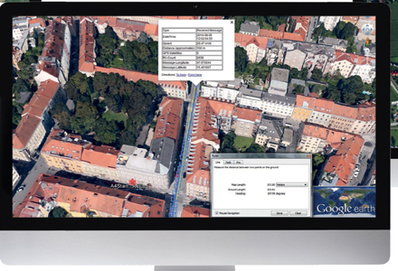
The project, undertaken by Gerald Markovic, Dr. Arno Eichberger, Sajjad Samiee and Branko Rogic analysed measured V2V tests in different areas and scenarios with the raw measurement results processed and categorised depending on the location and blocking objects between the cars. Differences in range and reliability were illustrated in GoogleEarth in order to consider the possible reasons for such variations in performance. V2V performance at intersections was closely analysed because of the high dispersion depending on the intersection’s geometry.
In the next step, the effects of wireless propagation were studied using a combination of geometric and (to accommodate random variables) stochastic models. The results were further divided into intersections in urban and suburban areas and a General Model was devised to cope with attenuating characteristics in motorway, rural and suburban environments.
In Europe the standard for V2V and V2I communications (collectively V2X) is ETSI-G5 which is based on 801.11p.
The Graz project deals with physical behaviour of V2V communications in the 5.9GHz band which was divided into five 10MHz channels dedicated to different tasks (two safety, two non-safety and one control). To standardise the communications process the transmitter power was set to 25dB and the receiver’s sensitivity to -95 dB and it was operated as an ad-hoc network (managed by the clients without a master or main device). This is the most likely scenario for V2X as ad-hoc networks do not require an external fixed infrastructure, provide the smallest possible latency with highly localised network loading and local privacy.
Cooperative Awareness
Testing concentrated on Cooperative Awareness Messages (CAM) such as warnings for emergency vehicles, collisions and intersection collisions, motorcycle approaching and slow vehicle indications, speed limit notification and ‘speed to green’.
Each connected item periodically transmits a notification including basic information such as a description (infrastructure, truck, car, ...) and GPS coordinates. The CAM messages provide considerable additional safety-related information for other V2X equipped road users and are transmitted between one and ten times every second as a minimum.
To test the transmission range and reliability, Markovic and his fellow researchers used two cars driving defined scenarios (convoy, semi-static and contraflow) in different areas including motorway, rural, suburban and urban locations. Each vehicle was fitted with V2V equipment from CohdaWireless configured to European standard with notification sent to the measurement unit each time a message was sent or received.
Table I shows all the results for driving on motorways, rural roads (green tint) and suburban areas (blue tint). It indicates how the viable communication distances for a full data transfer reduced from the optimum line-of-sight (LOS) scenario as more, or increasingly solid, objects come between the test vehicles. Although LOS communicable distances are more repeatable, Markovic says they should not be considered as universally representative as the variations, particularly in urban areas, are considerable.
To test the viability and variability of communications at intersections, one of the instrumented vehicles was parked next to a wall some distance from the centre of the intersection. The second vehicle was then driven towards the junction along the intersecting road from the direction masked by the wall and the point at which partial and full communications could be established were recorded as the distance from the centre of the intersection. These showed considerable differences in the results in suburban (blue tint) and urban (pink tint) locations as can be seen in Table 2.
Intersections in suburban settings fluctuate widely between various types of buildings and vegetation. Markovic says analysis of the junctions revealed that tall vegetation, such as hedges and shrubs, have a highly attenuating effect on the wireless propagation which underpins the connected vehicle concept. There was also variability because reflecting objects – for instance another vehicle at the intersection - may be a factor in one set of readings but may not be present when the next set of readings are taken.
Variations in the measurements obtained in urban areas were even greater and in one case full communication was only achieved when the test vehicle was less than 40m from the intersection junction. The amount of attenuation was also seen to be dependent on the number, size and composition of the objects between the two vehicles.
In order to predict the amount of attenuation created by the geographical configuration and the surrounding environment and a number of existing wireless propagation models were tried and while each worked in some scenarios, none worked in all circumstances. Therefore a simple General Model was created which took into account the road type and approximated the attenuation using the road type and estimating the amount and nature of blocking objects by viewing the area on GoogleEarth.
However, in comparison with the recorded distances, the calculated measurement showed an error for each of the 1Hz periodic broadcast messages. These ranged between less than 5m to more than 200m (and 0.6% to more than 24%).
Relative error (the distances calculated by the General Model compared with measured values) was at both its highest and lowest for the motorway readings with a hill creating the biggest errors, although the average error was the lowest at just over 9%.
Average error in rural areas was higher at slightly more than 11% (with buildings causing the highest variance) and was at its highest in suburban areas at more than 16%. To increase the weaker performance of suburban simulation, more input parameters and a specified suburban model will be required although this would compromise the aim of creating a simple model applicable in all situations. Most errors were negative, meaning the calculated distance was shorter than the measured.
Additional work will be necessary to evaluate the effect on communications when both cars are moving – which will be the practical situation in everyday traffic. It is also possible that the measurement error will increase in relation to the relative velocity between the transmitting and receiving cars.
When deployed an addition consideration will be the time taken for the driver to process the v2X information (probably displayed on the dashboard) and to act on that information – both of which are likely to increase with the age of the driver. And, when overall stopping distances are factored into the equation, providing an adequate warning at urban intersections where the measured communications distances can be at their shortest, may require additional infrastructure.
Further research is required as such inconsistency will create driver uncertainty about whether the road or intersection ahead is clear or if there is a problem but the signal has been blocked. Such reliability is paramount for drivers to accept and act on V2X communications and any inconsistency could be detrimental to road safety.
| ID | Manoeuvre | Distance (m) - Full connectivity | Objects between vehicles | Max distance (m)- partial connectivity |
|---|---|---|---|---|
| 1 | Convoy | 750 | Wood | 920 |
| 2 | Convoy | 625 | LOS | 700 |
| 3 | Convoy | 670 | LOS | 1200 |
| 4 | Convoy | 710 | LOS | 880 |
| 5 | Convoy | 645 | LOS | 760 |
| 6 | Convoy | 710 | LOS | 1300 |
| 7 | Convoy | 650 | LOS | 1600 |
| 8 | Convoy | 460 | Hill | 520 |
| 9 | Convoy | 420 | Wood | 580 |
| 10 | Convoy | 620 | LOS | 690 |
| 11 | Convoy | 890 | LOS | 910 |
| 12 | Semi - Static | 536 | Hill | 682 |
| 13 | Semi - Static | 500 | Hill | 570 |
| 14 | Semi - Static | 470 | Hill | 600 |
| 15 | Semi - Static | 380 | Hill | 510 |
| 16 | Contraflow | 818 | Wood &Wall | 1410 |
| 17 | Contraflow | 800 | Wood &Wall | 950 |
| 18 | Convoy | 325 | Buildings | 325 |
| 19 | Convoy | 250 | Building & Wood | 250 |
| 20 | Contraflow | 410 | Buildings | 410 |
| 21 | Contraflow | 280 | Buildings | 450 |
| 22 | Contraflow | 460 | LOS | 682 |
| 23 | Contraflow | 450 | LOS | 450 |
| 24 | General | 120 | Buildings & Wood | 220 |
| 25 | General | 90 | Buildings & Wood | 16 |
| 26 | General | 130 | Buildings & Wood | 200 |
| 27 | General | 90 | Buildings | 110 |
| Stationary vehicle | Moving Vehicle | |||
|---|---|---|---|---|
| ID | Distance to wall (m) | Distance to mid-intersection (m) | Distance to mid - intersection - full connectivity (m) | Distance to mid-intersection - partial connectivity (m) |
| 28 | 7.2 | 25.2 | 115 | 115 |
| 29 | 7.2 | 25.2 | 115 | 152 |
| 30 | 7.2 | 25.2 | 55 | 72 |
| 31 | 7.2 | 25.2 | 105 | 153 |
| 32 | 3 | 14.5 | 110 | 246 |
| 33 | 3 | 74.5 | 39 | 88 |
| 34 | 3 | 14.5 | 103 | 103 |
| 35 | 3 | 54.5 | 64 | 103 |
| 36 | 3 | 54.5 | 66 | 90 |
| 37 | 8 | 31.5 | 188 | 375 |
| 38 | 5 | 15.5 | 195 | 395 |
")
")
")
")
")
")

")
")
")