
The use if AWAM sensor technology has allowed Housten TranStar to achieve wide-area monitoring of roads, within its jurisdiction at a cost significantly lower than would have been possible using more traditional solutions
Houston TranStar is using Bluetooth sensors to collect speed and travel data in a project which is already demonstrating significant cost savings
"The 13-county region that Houston TranStar serves encompasses more than 12,300 square miles; that would make it the thirty-seventth US state by size, and larger than the state of Indiana," says John R. Whaley, director of Houston TranStar.
"If our region were a state, it would be fifteenth-biggest in terms of population. And this Southeast Texas region has significant traffic congestion, so we need to provide valuable, meaningful travel information to our residents and help them navigate through traffic." Houston TranStar, a unique, four-agency collaboration, has reliably and efficiently informed drivers of expected travel times and traffic issues on the region's most frequented highways since its inception in 1993. The system predominantly uses a combination of AVI and radar to gather and publish travel time and speed information. More than 450 of these sensors are in use along the region's freeways.
Stormy beginnings
Back in 2005, as Hurricane Rita bore down upon the Texas Gulf Coast, more than 3 million residents from the region attempted, almost simultaneously, to evacuate their homes and neighbourhoods. As the hours passed, transportation and emergency management officials at Houston TranStar realised that they lacked information about the progress of vehicles evacuating northbound from the coastal area. AVI speed sensors and CCTV coverage only extended 33 miles from downtown, failing to capture the growing traffic snarl-up occurring beyond the cameras' scope. Two days before Hurricane Rita's anticipated landfall, an unmoving line of traffic sat on IH-45 North, the preferred evacuation route, from downtown Houston to FM 1488. The trail of vehicles spanned more than 30 miles."Without camera views or traffic information outside our coverage area, we had no idea where the choke points were or how to address the problem," says David Fink,
The search for cost-efficiency
Fortunately for hundreds of thousands of Texans, Hurricane Rita turned and moved into western Louisiana, sparing the most heavily populated centre in the Gulf Coast. After that near miss, Houston TranStar staff decided that they needed reliable, valid, real-time speed data along IH-45 northbound to prevent a recurrence of the Hurricane Rita evacuation nightmare. But existing AVI technology would be prohibitively expensive, US$400,000 for the 43-mile stretch; costing more than $75,000 per unit, fibre connects the sensors, whose installation and maintenance usually require lane closures, causing traffic delays.So transportation planners at TranStar created a list of requirements for a proposed new speed data system. They sought a methodology that would capture data on arterials as well as freeways. Given the state of the economy, the organisation needed a much cheaper option than the traditional AVI system. The system had to be easily and quickly deployed and maintained and, in the event of a hurricane, replaced. TranStar wanted to own the system hardware and software outright rather than pay leasing or proprietary software costs. The technology had to be expandable, so it had to be standards-based, adaptable and compatible with existing speed data equipment. And any implemented system had to be capable of publishing its real-time data on the TranStar website.
In 2008, Houston TranStar directed the Texas Transportation Institute (TTI), a unit of the Texas A&M University System, to research products that might capture traffic speed data and meet all the above criteria. The project was originally funded with local funds furnished by the City of Houston.
TTI first examined License Plate Recognition (LPR) technology, a reliable, accurate and historically proven system that costs $25,000 per four-lane installation (where each lane requires a separate sensor). However, the LPR technology proved to be even more costly than AVI; implementing LPR on that segment of IH-45 North would have cost more than $500,000.
"LPR technology is sound, and except for the price, would have been a satisfactory addition to TranStar's speed data collection toolkit," says TTI research scientist Darryl Puckett, "but we needed to cover a large area and wanted a system that would be expandable at a reasonable cost. LPR just didn't meet those criteria."
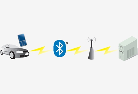
Next, TTI assembled prototype hardware capable of collecting IP addresses at the roadside from Bluetooth-enabled personal electronic devices such as cellular telephones. Anonymous Wireless Address Matching (AWAM) technology uses unique addresses within Bluetooth devices to determine segment travel times and speeds. AWAM hardware can be built from readily available off-the-shelf components. TTI then set about creating the software to determine average speeds and travel times.
Initial testing and installation
After determining the feasibility on a local arterial, TTI installed AWAM speed sensors alongside traditional AVI toll tag readers on a short (2.2-mile) stretch of freeway near Houston's inner city. Researchers wanted to compare speed data quality and quantity.Because of the relative newness of Bluetooth technology, researchers were concerned that there might be insufficient data to provide accurate speed information. However, after evaluating data from the 2.2-mile segment in a 24-hour period, 3,271 toll tag speeds were captured compared to 2,492 Bluetooth speed data samples (Figure 1). Researchers were satisfied that there were sufficient Bluetooth devices on the roadway to produce adequate speed data saturation and tests show that Bluetooth-enabled cell phone numbers continue to increase.
Further, after comparing speed data from the two methodologies, TTI researchers were certain that the Bluetooth reader captured reliable information. After a few adjustments to correct for obvious outliers (that is, vehicles traveling less than 5mph on a freeway) the two sets of data were virtually the same (Figure 2), so Houston TranStar quietly began installing and monitoring sensors on IH-45 North along the evacuation routes as well as on a few major local streets.
After the team was satisfied that AWAM technology enjoyed an accuracy rate as high as that of the AVI system, they published the IH-45 North data on the TranStar website connecting data from the AVI readers, providing seamless travel speed information from downtown Houston northward. By year-end, Bluetooth readers will blanket IH-45 from Houston to Dallas for more than 300 lane miles of coverage. That, however, is only the beginning.
Large-scale cost savings
Houston TranStar measures success by the quality of data produced by cost-effective technologies for its customers (the public, web visitors, the media and others). Because the region is so large, millions of dollars can be saved with AWAM technology: a single turnkey Bluetooth sensor installation costs only $2,000, while the traditional AVI installation averages $75,000 and often requires lane closures that disrupt traffic flow. The total cost for five AWAM sites along the 76 directional miles of IH-45 North was less than $10,000.Puckett: "There's no downside to the use of Bluetooth sensors. The low equipment cost and ease of deployment, low maintenance costs, compatibility with existing speed data technology - it's all positive. We were looking for an expandable, standards-based system that could be adapted to a variety of locations. Significantly, the system doesn't require proprietary hardware, so there aren't add-on costs over the long term." The Texas Department of Transportation will be deploying AWAM sensors along hurricane evacuation routes on IH-10 West and US 290 West as well as IH-45 North. Harris County and the City of Houston are also installing a number of Bluetooth sensors in their respective jurisdictions to provide much-requested arterial traffic information to the Houston TranStar website, which until now has displayed speed data exclusively on freeways and high-volume state roads. The sensors, of which more than 450 are planned, will cover 487 linear miles and blanket a significant portion of heavily congested roadways. The City of Houston's expansion should be complete by the end of this summer. Harris County plans to complete its project by the first quarter of 2011.
As Houston TranStar continues to evolve this innovative and cost-effective project, the technology will allow for timely attention to traffic signal failures and traffic incidents, and give real-time traffic summary calculations. Eventually, Houston TranStar will also satisfy the increasing public demand for predictive travel times on its website.
Growing AWAM sensor penetration is one way Houston TranStar measures success. As the Bluetooth system grows, devices will cover more local roadways, increasing speed sample sizes and improving the quality of data. Within minutes the information gathered will be posted to the TranStar website where it will be available to the public from a computer or web-enabled cellular device. The project sets a new standard for others to follow by generating significant improvements without expending scarce resources.
 on 1 October 2009 from 5.00am to 8.00pm")
 and AVI (Blue) speed data samples on I-610 northbound from I-10 to Ella (2.2) Miles on 1 October 2009")
")
")
")
")
")
")
")
")

")