
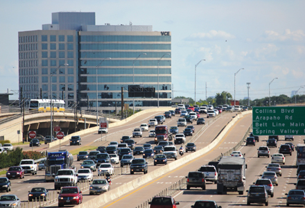
The US-75 and red line corridor is a vital artery for the Dallas metropolitan area of six million people
New systems of software are coming together to form the technological backbone of a project that will apply practically to one corridor in Dallas, but influence travel across a wider area.
The principal aim is to enhance the efficiency of travel through what is a vital corridor of Dallas Fort Worth – a metropolitan area of six million people and rising – by making better use of its capacity as a whole when needs arise. Practical elements are essentially action plans of response to traffic problems, coordinated between the project stakeholders. Support will come from systems of software, which will collate and distribute data among the many agencies involved. Subsystems of the ICM technology will include an innovative ‘decision support system’ to be overseen by a central ICM coordinator.
Definition of the scheme’s reach is necessary for its implementation and measurement of success, but an additional ‘travelshed’ boundary of influence has also been defined. This will take in further roads and transit routes that may be affected by traffic incidents or events within the US-75 corridor. From downtown Dallas the travelshed extends westward to the Dallas North Tollway, northwards to the SH-21 highway and east to the DART blue line (see map). Furthermore, another major element instigated by the Dallas ICM partners – a new 511 travel information service – will extend out wider still.
In addition to DART, the Dallas ICM partners or stakeholders number 13 cities, including those of Dallas, Richardson, Plano and University Park, plus the Town of Highland Park, the North Texas Tollway Authority and the Dallas District of the Texas Department of Transportation (TxDOT). It is at TxDOT’s DalTrans traffic management facility where DART is resident, where the Dallas ICM will operate from and where the ICM coordinator (a DART employee) will sit, overseeing a system designed to complement partner agencies’ existing systems.
Autonomy maintained
“A major change we have seen here in recent years is the development of regional TMCs (traffic management centres) over a large area. The individual agencies will still control their networks with their own facilities. The Dallas ICM maintains autonomy for all partners, but with a series of pre-approved response plans, coordinated and triggered by data collected and shared via the ICM systems,” says DART’s assistant vice president for mobility programs development Koorosh Olyai.Traffic and transit data collected by at least nine different partners or sources will be collated at the ICM nerve centre – as feeds for a ‘SmartFusion’ subsystem. Data providers include traffic monitoring systems covering US-75 and parallel and arterial roads within the ICM corridor, third party traffic and weather information, and several data feeds from DART.
The red line of the transit operator’s light rail network runs virtually parallel to US-75 through the ICM corridor and DART’s buses ply the same network of roads where new transit signal priority and real-time information systems are being developed. Vehicle locations, passenger counts and capacity information will be fed into SmartFusion, transmitted from GPS and radio equipment fitted to all DART light rail cars and buses. Parking availability at five park and ride sites along the red line will feed into the system as well.
How all this data will be used is multifarious: it will feed straight back out again for ‘data subscribers’ and to all partner agencies to view and use via an internet-based ‘SmartNet’ subsystem; it will be disseminated to the public through the new multi-media travel information service 511 DFW (Dallas Fort Worth); and it will fuel a decision support system (DSS) – the third principal subsystem of the ICM ‘logical architecture’ with SmartFusion and SmartNet.
A ‘soft launch’ of 511 DNW will take place later this year, involving internal distribution and access for partners to try out, test and get used to the software and its user interfaces. Full operation of all ICM systems is due early in 2013.
Strategic responses
The DSS will evaluate data fed from SmartFusion and use a ‘predictive engine’ and a built-in system of rules to suggest actions for participating agencies to deploy for averting or dealing with traffic problems as they start to develop. This is to support a range of strategies being formulated for responding to traffic incidents or events, which is where the Dallas ICM appears to become complex, because of the vast number of response plans being developed.Ahmad Sadegh is vice president of
Put simply, the main action plans will deal with traffic incidents and congestion on US-75 by diverting vehicles to parallel roads with appropriate use of ITS systems and signal timing plans. According to Olyai, as queues increase, further arterial roads will be added to route diversions and then transit capacity will be brought into play. “The strategy expands with the severity of the incident,” he says.
Sadegh adds: “On a typical day, the freeway, arterial streets and transit system are operated to move people and vehicles as efficiently as possible in the US-75 corridor. However, normal operations may not be sufficient when an incident, weather or high demand event occurs. Specific ICM response plans have been designed under route and mode shift strategies to offer alternate travel options when such conditions arise. The Dallas ICM system will monitor all strategic routes and modes and suggest to the operating agencies an ICM response plan with the greatest overall benefit. Each agency will implement its part of the strategy in the corridor.”
Available capacity has been identified on three adjacent roads to be used as diversion routes within the ICM corridor. This availability varies with time of day, however, so response plans and decision support vary in accord with real-time monitoring of traffic and transit conditions on all networks within the corridor.
Cost benefits
“The ability of the parallel arterials to handle traffic was confirmed during the analysis, modeling and simulation phase of the ICM project,” Olyai says. “The modeling assessment showed as much as a 20:1 benefit to cost could be achieved by implementing alternative diversion routes and modal shifts.”The Dallas ICM is not intended as a congestion busting tool, Sadegh adds, but reduction of congestion should become a by-product of more effective response to incidents and management of the various modes of travel. The official objective is ‘operation of the US-75 corridor in a true multimodal, integrated, efficient and safe fashion where the focus is on the transportation customer’. Individual agency projects spilling out of this include ‘responsive traffic signal’ systems, arterial street monitoring and improved measures for transit signal priority and parking and freeway management.
It is the new 511 DFW service which is expected to serve to greatest effect, however, due to its geographical reach for informing people throughout the nine counties of the DFW Metroplex. “A new more comprehensive and far reaching 511 service was identified as a priority early on by the Dallas ICM partners,” says Olyai.
“The vision from day one was to involve more partners and agencies beyond the defined boundaries. Integration of operations and physical activities of the ICM project are limited to the defined corridor, but 511 DFW extends much further, which is important. If people are travelling from 50 or 100 miles out, they are unlikely to gain much benefit from an information system concerning US-75 only, but if they have information on their entire route, including US-75, then they have it all for better journey planning.”

")
")
")
")
")
")
")
")

")