
HERE Drive - My commute displays on a Windows phone
Pete Goldin examines Nokia’s rationale for combining its location services, digital mapping and other capabilities under the HERE brand.
While it has divested itself of its mobile phone business to2214 Microsoft, 183 Nokia has kept hold of its HERE business unit and brand which incorporates the company’s location services with digital mapping and other capabilities. The creation of HERE is much more than rebranding as its services are heading off the map and into the cloud. “HERE offers the first location cloud that delivers the world’s best maps and location experiences across more screens and operating systems unified under the HERE brand,” says Aaron Dannenbring, vice president of global product marketing and field operations, Nokia.
Dannenbring explains that the company offers a comprehensive set of location services “built to work together to deliver the most intuitive and customisable way to discover, navigate and explore the world around you.”
There are five products under the HERE banner: Maps, Drive, Transit, City Lens and Traffic. Each is optimised for how users use location services, helping them discover and navigate to places more easily and intuitively so they get where they want to go faster and more efficiently.
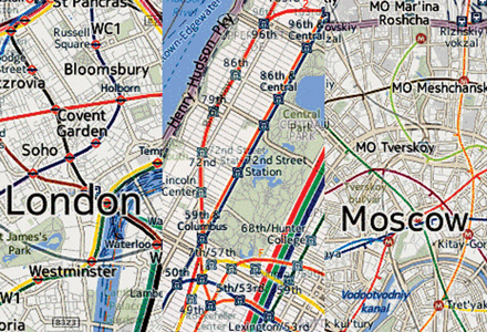
The Maps application features offline maps of 95 countries and includes LiveSight, which enables the user to follow virtual signs on the screen of a mobile device displaying information about local businesses and attractions. Drive+ provides voice-guided driver navigation in 95 countries from Andorra to Vietnam although not for Japan. Transit offers detailed bus, train, and subway information and dedicated directions for walking in more than 720 cities globally and City Lens overlays selected shops, restaurants and points of interest as virtual signs on the user’s phone screen. Finally the Traffic application provides real-time traffic updates in 34 countries covering much of the Americas and Europe and sections of Asia Pacific with the notable exceptions of China and Japan.
“These new experiences are connected and work together, making it easy to transition seamlessly between walking, driving and transit as you move along your day,” Dannenbring explains, adding: “All of these combined create a discovery and navigation experience that can’t be matched by any single app in the marketplace today.”
All applications access data from the HERE cloud, so users can save a favourite on the here.com website and access it via their smartphone or other mobile device while on the move.
“Our user base is every consumer who might utilise a location-based application that we created or enabled with our services, or that utilises our map and content,” says Dannenbring.
The number of consumer applications is vast and includes standard navigation platforms used by in-vehicle navigation systems, PNDs (portable navigation devices) and smart phones. In addition there are website and smart phone applications that provide various location-based services powered by HERE data and services.
“HERE is the global leader in maps, navigation and location services,” says Tim Shepherd, senior analyst at independent analyst firm Canalys. “Its maps are used in huge numbers of the dedicated GPS satellite navigation devices and embedded in-car navigation solutions from leading manufacturers around the world.”
Dannenbring says: “Beyond the consumer, our content is widely used for enterprise and government applications – especially in the areas of geomarketing, fleet management and geocoding,” adding that the company licenses its content in multiple ways.
Part of its stated mission is to redefine location services and digital mapping for the mobile world. This includes making the mobile experience more significant for end users.
At the time of the company’s launch, Nokia president and CEO Stephen Elop said: “With HERE we can extend our 20 years of location expertise to new devices and operating systems that reach beyond Nokia. As a result, we believe that more people [will] benefit from and contribute to our leading mapping and location service.”
For example, Nokia launched a maps application for iOS,493 Apple’s mobile operating system, under the HERE brand. Based on HTML5, it includes offline capabilities, voice-guided walk navigation and public transport directions. The application is available for free download from Apple’s App Store.
Nokia also demonstrated an Android OS-based reference application and announced plans for the availability of a HERE SDK for Android OEMs in 2013. This software development kit will enable partners to create location-based applications for Android devices with HERE content.
In addition, the company has announced the global release of HERE Drive+ (currently restricted to Nokia Lumia devices) for all Windows Phone 8 smart phones.
“On top we offer a variety of ADAS (advanced driver assistance systems) and HERE Traffic products which greatly enhance the ability of companies and governments to improve the efficiency of their transportation networks or services.
“Finally, we are a leader in the multi-modal transportation by providing parking, transit and last mile navigation that greatly improves performance and user confidence,” he adds.
As an example of commitment to the ITS industry, the company recently announced integration of its real-time traffic information with ArcGIS Online and ArcGIS for Transportation Analytics products from50 ESRI, a provider of geographic information system (GIS) mapping software.
Using HERE Traffic, ESRI will enhance its web and cloud-based location platform with more precise traffic data for intelligent routing.
According to HERE, the real-time traffic data is gathered from a variety of sources, including the world’s largest compilation of both commercial and consumer probe data and the world’s largest fixed proprietary sensor network. In addition there is also event-based data collected from government and commercial sources and billions of historical traffic records.
The freshness of the data enables the traffic application to provide a more accurate picture of traffic conditions. The company currently processes 20 billion real-time GPS probe points a month, with almost half of all the data less than 1 minute old and more than three-quarters less than 5 minutes old.
Using HERE Traffic via ESRI, fleet operators will be able to better manage problems as they occur in real-time, rerouting fleets when traffic congestion arises and providing alerts when pickup or delivery delays occur.
He continues: “On a global average basis, our map content powers four out of five cars with fully integrated in-dash navigation systems. Our apps offer the only true offline maps experience, the largest indoor map inventory and largest public transport coverage experience of any location service to date.”
As the world changes every second, one of the company’s most important challenges is to maintain the quality of its maps. “It is far harder to maintain a map than to build a map the first time,” Dannenbring says.
“We invest heavily in capabilities designed to detect, process and integrate as much change as possible - and we excel in this area,” he explains. “We process up to 2.7 million changes to our database every day. This ensures the freshest data and the best possible experience for the end user.”
This is one aspect of the firm’s concept of a ‘living map’. The other aspect is the notion of computational cartography – basically delivering a personalised, more contextual experience for every user, derived from its products.
“In this way the map lives with the user,” Dannenbring notes. “Concretely this means we layer activity data – such as real-time traffic generated from user activity – on the map so that the experience of the user or enterprise customer reflects what is happening in real-time.”
Examples include real-time traffic, restaurant check-ins and real-time transit data.
According to Dannenbring, HERE is differentiated from other digital mapping services with the broadest turn-by-turn offering in the industry, covering more countries than any other provider and an unyielding commitment to quality and database accuracy.
Furthermore, he says Nokia is a market leader in innovation, with a history and commitment to being first to market with many new capabilities.
Since being set up late last year, HERE has continued to advance its mapping capabilities. For example, to enhance its 3D mapping capabilities, Nokia announced plans to acquire California-based Earthmine. The reality capture and processing technologies of Earthmine will become integral to the company’s 3D map making.
In conclusion says Dannenbring says: “Over the next 12 months you will see advancements in data freshness, additional deployment of innovative content – such as Natural Guidance – and a continued focus on enterprise applications.”
In essence, it really is a case of ‘watch this space’.
While it has divested itself of its mobile phone business to
Dannenbring explains that the company offers a comprehensive set of location services “built to work together to deliver the most intuitive and customisable way to discover, navigate and explore the world around you.”
There are five products under the HERE banner: Maps, Drive, Transit, City Lens and Traffic. Each is optimised for how users use location services, helping them discover and navigate to places more easily and intuitively so they get where they want to go faster and more efficiently.
The Maps application features offline maps of 95 countries and includes LiveSight, which enables the user to follow virtual signs on the screen of a mobile device displaying information about local businesses and attractions. Drive+ provides voice-guided driver navigation in 95 countries from Andorra to Vietnam although not for Japan. Transit offers detailed bus, train, and subway information and dedicated directions for walking in more than 720 cities globally and City Lens overlays selected shops, restaurants and points of interest as virtual signs on the user’s phone screen. Finally the Traffic application provides real-time traffic updates in 34 countries covering much of the Americas and Europe and sections of Asia Pacific with the notable exceptions of China and Japan.
“These new experiences are connected and work together, making it easy to transition seamlessly between walking, driving and transit as you move along your day,” Dannenbring explains, adding: “All of these combined create a discovery and navigation experience that can’t be matched by any single app in the marketplace today.”
All applications access data from the HERE cloud, so users can save a favourite on the here.com website and access it via their smartphone or other mobile device while on the move.
“Our user base is every consumer who might utilise a location-based application that we created or enabled with our services, or that utilises our map and content,” says Dannenbring.
The number of consumer applications is vast and includes standard navigation platforms used by in-vehicle navigation systems, PNDs (portable navigation devices) and smart phones. In addition there are website and smart phone applications that provide various location-based services powered by HERE data and services.
“HERE is the global leader in maps, navigation and location services,” says Tim Shepherd, senior analyst at independent analyst firm Canalys. “Its maps are used in huge numbers of the dedicated GPS satellite navigation devices and embedded in-car navigation solutions from leading manufacturers around the world.”
Dannenbring says: “Beyond the consumer, our content is widely used for enterprise and government applications – especially in the areas of geomarketing, fleet management and geocoding,” adding that the company licenses its content in multiple ways.
Part of its stated mission is to redefine location services and digital mapping for the mobile world. This includes making the mobile experience more significant for end users.
At the time of the company’s launch, Nokia president and CEO Stephen Elop said: “With HERE we can extend our 20 years of location expertise to new devices and operating systems that reach beyond Nokia. As a result, we believe that more people [will] benefit from and contribute to our leading mapping and location service.”
For example, Nokia launched a maps application for iOS,
Nokia also demonstrated an Android OS-based reference application and announced plans for the availability of a HERE SDK for Android OEMs in 2013. This software development kit will enable partners to create location-based applications for Android devices with HERE content.
In addition, the company has announced the global release of HERE Drive+ (currently restricted to Nokia Lumia devices) for all Windows Phone 8 smart phones.
HERE for ITS
“We are a key partner in the ITS industry,” notes Dannenbring. “We serve a number of enterprise customers with high quality map and content products.“On top we offer a variety of ADAS (advanced driver assistance systems) and HERE Traffic products which greatly enhance the ability of companies and governments to improve the efficiency of their transportation networks or services.
“Finally, we are a leader in the multi-modal transportation by providing parking, transit and last mile navigation that greatly improves performance and user confidence,” he adds.
As an example of commitment to the ITS industry, the company recently announced integration of its real-time traffic information with ArcGIS Online and ArcGIS for Transportation Analytics products from
Using HERE Traffic, ESRI will enhance its web and cloud-based location platform with more precise traffic data for intelligent routing.
According to HERE, the real-time traffic data is gathered from a variety of sources, including the world’s largest compilation of both commercial and consumer probe data and the world’s largest fixed proprietary sensor network. In addition there is also event-based data collected from government and commercial sources and billions of historical traffic records.
The freshness of the data enables the traffic application to provide a more accurate picture of traffic conditions. The company currently processes 20 billion real-time GPS probe points a month, with almost half of all the data less than 1 minute old and more than three-quarters less than 5 minutes old.
Using HERE Traffic via ESRI, fleet operators will be able to better manage problems as they occur in real-time, rerouting fleets when traffic congestion arises and providing alerts when pickup or delivery delays occur.
On the map
“Digital mapping is the cornerstone of our business,” Dannenbring says. “We pioneered digital mapping and navigation nearly 25 years ago and are a recognised leader in the field. Our location services provide easy access to our mapping and other location content. This yields many benefits to customers including speed of product development, improved accuracy, lower development costs and a better overall experience.”He continues: “On a global average basis, our map content powers four out of five cars with fully integrated in-dash navigation systems. Our apps offer the only true offline maps experience, the largest indoor map inventory and largest public transport coverage experience of any location service to date.”
As the world changes every second, one of the company’s most important challenges is to maintain the quality of its maps. “It is far harder to maintain a map than to build a map the first time,” Dannenbring says.
“We invest heavily in capabilities designed to detect, process and integrate as much change as possible - and we excel in this area,” he explains. “We process up to 2.7 million changes to our database every day. This ensures the freshest data and the best possible experience for the end user.”
This is one aspect of the firm’s concept of a ‘living map’. The other aspect is the notion of computational cartography – basically delivering a personalised, more contextual experience for every user, derived from its products.
“In this way the map lives with the user,” Dannenbring notes. “Concretely this means we layer activity data – such as real-time traffic generated from user activity – on the map so that the experience of the user or enterprise customer reflects what is happening in real-time.”
Examples include real-time traffic, restaurant check-ins and real-time transit data.
According to Dannenbring, HERE is differentiated from other digital mapping services with the broadest turn-by-turn offering in the industry, covering more countries than any other provider and an unyielding commitment to quality and database accuracy.
Furthermore, he says Nokia is a market leader in innovation, with a history and commitment to being first to market with many new capabilities.
Since being set up late last year, HERE has continued to advance its mapping capabilities. For example, to enhance its 3D mapping capabilities, Nokia announced plans to acquire California-based Earthmine. The reality capture and processing technologies of Earthmine will become integral to the company’s 3D map making.
In conclusion says Dannenbring says: “Over the next 12 months you will see advancements in data freshness, additional deployment of innovative content – such as Natural Guidance – and a continued focus on enterprise applications.”
In essence, it really is a case of ‘watch this space’.


")

")
")

")
")
")

")