
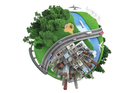
Traffic control is increasingly being viewed as one essential element of a wider ‘system of systems’ – the smart city. Jason Barnes, Jon Masters and David Crawford report on latest ideas and efforts for making cities ‘smarter’
Virtually every element of the fabric and utilitarian operations that make urban areas tick can now be found somewhere in the mix that is the ‘smart city’ agenda. Ideas have expanded and projects pursued in different directions as the rhetoric on making cities ‘smarter’ has grown. Approaches vary, as do the descriptions of what a smart city looks like. The concept can still be framed by a loose overall definition however, with technology as a central or underlying theme and transportation as a key aspect.Transport alone receives a number of descriptions under the ‘smart’ agenda. Smart mobility, as described in Europe for example, takes in promotion of multi-modal journey planning allied to other efforts aimed at making transport more efficient, with less congestion and pollution. Other initiatives have emerged for smart energy, communications, safety, buildings, public services and utilities.
The main objectives are improving quality of life for citizens, bettering the way cities work or reducing the impact of climate change, or all three. For reaching these aims, integration of the various elements would appear to be vital, if the overall effect is to be greater than the sum of the parts. Otherwise the notion of a smart city would appear to be meaningless. From Monitoring to Management
“But what we have presented the traffic engineer with is an opportunity to move from monitoring to management. In a study using data for a major city in northern Europe, IBM was able to predict where congestion would occur with great accuracy and then present three implementation scenarios. This is where we can provide crucial decision support. Scenario A would give an 87% chance of avoiding congestion occurring with no effects elsewhere on the network; Scenario B would give a 93% chance but with some knock-on effects; and Scenario C would give 100% but with greater ramifications elsewhere.
“Stochastic forecasting takes a significant amount of time and so we undertake deep analysis of historical data. For traffic, that might mean taking six months’ worth of data and searching for patterns. When the software sees certain conditions, it recognises from those analyses what’s about to happen. Our tools can analyse data in real-time but it’s the combination of that with patterns derived from historical data which enhances the confidence values.” JB
“If a city is merely focusing on one target, such as mobility, then it is difficult to justify this as a smart city initiative, unless it is part of a longer term vision,” says
Central to Telvent’s offer for smart city initiatives is an Integrated City Management Platform for developing common ICT across different city departments or projects. Sharing of information is a defining principle. “Smart city is evolving as a concept and market. We’re seeing a lot of different ideas, typically starting with a single priority such as adaptive traffic management systems and some integration of transport, or a focus on energy or communications,” Vallejo says. “Where cities have a long term vision the intension is to expand the scope, in one or two cases to mitigation or management of urban flooding and to street lighting, step by step.”
Critical connections
The Climate Group, consultants Arup and
The report gives the results of a 2011 survey of progress by the 58 cities of the C40 Climate Leadership Group. Technology-based schemes reported include smart energy metering, implemented by 17 cities, and building energy management systems which have been installed by 13 cities. Six have taken the major step to developing smart grids using sensors and instrumentation to improve the efficiency of energy distribution.
In transport, 18 cities have introduced smart card ticketing systems. The same number provide real-time travel information, 10 have launched cycle hire schemes and between eight and 14 have buses, trains and some cars running on renewable electricity.
According to Information Marketplaces, a lack of connection between these initiatives and common ICT strategies is preventing real value to be extracted from the many different projects. Of 36 cities interviewed by the C40 group, ‘none had a strategic plan in place to set a vision or policy framework for putting major technology trends into their city planning’, says the Climate Group’s report.
Strong leadership is a key requirement for overcoming a number of big challenges, not least the integration or restructuring of cities’ governance and operating structures. Conventional silo arrangements have city departments competing for funds rather than working together to find mutually beneficial ways to invest and make the money go further. Such archaic governance combines with poor infrastructure to produce some staggering statistics; in certain parts of the world, it’s estimated that 30-40% of all fresh water and 40-70% of electricity is lost in transmission to the end user. There’s a need to arrest such waste, to allow the lost money to be recovered and then spent more usefully.
Added intelligence
“We have to find ways of making existing infrastructure work better. Fortunately, we’re already well on the way to doing that. We just don’t necessarily know it yet,” says associate partner at IBM Global Services Michael Noblett. “Many individual departments have made significant progress in instrumenting their infrastructures and adding control capabilities. In the transport sector, for instance, hundreds of millions of dollars have been invested in traffic management centres. But most of these do very little real management of traffic and tend to be reactive rather than proactive in nature.”Of all advanced traffic management systems (ATMS) installed at intersections, only about 3% are regularly instructed to deviate from normal operations and take account of real-life traffic situations. “That represents a huge infrastructure investment that’s already been made and which could be leveraged to better effect,” Noblett says.
IBM has been a prime mover in developing the smart city agenda. The company’s Smarter Cities take on the concept involves application of software solutions across cities’ various domains. “This way we enable separate entities to work as a group. Instead of working on principles designed to optimise one entity’s agenda, which is not always the same as what’s best for the system or city, they can work as a whole,” Noblett says.
High level changes
IBM’s foundational Smarter Cities software can be applied across all types of domain. Only specific applications for operations such as traffic management are different. That eases inter-agency communication, but also allows some fundamental changes to how things are done at a higher level.“The mayor of a city will want a different view on things than the individual domain operator,” Noblett says. “He or she may want access to a dashboard that allows control of the city, not just the road network, but there is still a need to be able to drill down to the individual domain level. Across domains, emerging situations which will have an impact elsewhere can be shared, as well as the more mundane, such as maintenance schedules. While sharing of information and coordination of scheduled works might seem an obvious thing to do, in reality it rarely happens and the knock-on effects can be dramatic.”
Noblett summarises IBM’s Smarter Cities concept by referring to ‘Three ‘I’s’: Instrumentation (the sources of data); Interconnectedness (a customisable model which allows any agency to talk to any agency); and Intelligence (turning the first two into actionable information). Another notable aspect is the way in which smart cities concepts allow easy addition of new data feeds, such as those from social networking. “In the traffic domain there is a very powerful correlation between congestion and incident response times, which could be positively influenced by crowd sourcing feeds such as Twitter,” he explains.
“Social media is a fine example of how we can ‘add’ instrumentation without additional public infrastructure investment. We may only hear of an incident or occurrence five to 10 minutes earlier than we might have done otherwise with ‘traditional’ information sources, but the impact of those few minutes can be phenomenal.” JM, JB
Greenest is the target for Vancouver
Vancouver has set 2020 as its target date for becoming the ‘greenest city in the world’. According to the city’s Greenest City Action Plan launched in 2009, streets, public spaces and neighbourhoods ‘should be vibrant places that are alive with people, plants and activities in a framework of integrated transport and transport-integrated development’.
Transport targets of Vancouver’s plan include making over 50% of trips by foot, bicycle, and public transport; and reducing the average distance driven per resident by 20% from 2007 levels. In 2008, around 40% of trips to and within the city were by foot, bike, or transit, up from 33% in 1994. With a high number of residents using the 19.2km automated Canada Line that opened in 2009 between Vancouver’s airport and city centre in time for the 2010 Winter Olympics, these numbers have continued to grow.
Vancouver has used the Canada Line route as a centreline for locating new development schemes in an effort to increase urban density and optimise use of the rail link. The city is now widening this linear zone. A further planning initiative with the same aims is the EcoDensity project. Backed by fresh legislation (designed to protect views and privacy but to get rid of the ‘not in my backyard’ (NIMBY) factor), this uses ‘back lane’ sites to squeeze in additional houses of ‘green’ modern design. The city reckons that there are a potential 66,000 such sites.
The Winter Olympics allowed Vancouver a demanding test of its sustainable transport policy, which established that there would be no overall increase in road capacity, placing the emphasis on ITS for traffic management and use of alternative modes. Legacies include continuing high use of mass transit, following record levels established during the games, and a travel website (www.
The website incorporates results from surveys showing that, of the critical factors motivating people to choose a particular travel mode, time is more important than cost; and that, while environmental concerns are important, they are not strong enough on their own to change driving behaviours. The site therefore actively promotes car sharing, through one of three local car clubs and ride sharing schemes.
ITS deployment for traffic management in Vancouver is currently focusing on suburban areas, with an emphasis on traffic radio rather than large scale use of variable message signs on environmental grounds. In the transit field, however, iCubic Corporation’s business unit
The system is using Cubic’s Nextfare technology to provide both conventional smartcard ticketing and open payment capability to accept bank cards and other media. It will be implemented on all three routes of the automated Sky Train network, of which the Canada Line is one, plus four other services including the SeaBus passenger ferry linking central Vancouver to its North Shore communities. DC Holistic first for growing Brisbane
Australia’s third largest city, Brisbane, is looking forward to the prospect of gaining the first ever ‘holistic’, real-time picture of its entire private and public transport network, as the core product of its new Smart Transport Research Centre (STRC). Based at the city’s Queensland University of Technology (QUT), the STRC – which opened in 2011 – claims to be tackling Brisbane’s transport stress points “head on” with research based solutions that it hopes can later extend to the rest of Australia – and possibly wider.
The STRC is combining expertise from government agencies, private sector partners Thales and IBM, plus QUT and other universities. STRC’s ‘action areas’ include predictive routing for better journey planning; congestion reduction by enhanced traffic management strategies; and greater use of public transport. The initial congestion-driven emphasis has been on traffic management.
Among the STRC’s first year achievements are an agreement secured from a group of Australian road authorities to support a new network operation standard; and a start on a scalable development framework for traffic engineering solutions. The STRC has also produced a prototype mobile phone application designed for customised travel prediction to enable people and goods movement by the best route and transport mode. “From 2012 we are going multi-modal all the way,” says STRC director Edward Chung.
Year-end targets include an online simulation of the whole Brisbane metropolitan area, based on real-time data feeds, with reliable journey time prediction as the platform for enhanced traveller information. Among aims for 2013 are a multi-modal trip planner and a decision support system for road network operation.
“STRC tools, algorithms and applications are being built with scalability as a key component. The concept of holistic modelling requires integration of densely populated urban districts and rural areas targeted for future development for accommodating steep increases in population,” Chung says. “The standardisation efforts of STRC on traffic data and transport-related software development have already gained international attention. Being driven as an open source project, they also have the potential to expand the concept beyond Australia.” DC A game of three thirds
One third of all travel by car, a third by public transport and the rest by bike. That is the plan at the heart of
By that time, Copenhagen expects its link with the southern Swedish city of Malmö via the Öresund Crossing to have made both cities a new business and academic hub for Scandinavia. Five years earlier, the island-hopping Fehmarn Belt Fixed Link will have shortened the rail journey from Hamburg in north Germany from four hours and 45 minutes to three hours and 15 minutes. The result of these developments will be increased travel and traffic pressures on the Danish capital. One response is a regional planning regime aimed at ensuring that the Nordhaven docklands ‘green’ development zone 4km from the city centre is progressed alongside an extension to the metro system and direct cycle lanes.
The city has predicted that a high environmental quality of life will persuade families that would otherwise move out into the suburbs to stay close to the central area, so reducing the need for travel. (It has already cleaned up its harbour, so creating a new leisure destination district).
Public transport is already well developed and integrated in Copenhagen. Cross-service ticketing has been operational for over a decade and the new ‘rejsekortet’ electronic travel card is due to be fully implemented in summer 2012. SMS-based ticketing, via a joint venture between all transit operators, has been available since November 2010. Most mobile phone companies are offering the service, which now accounts for 60% of all single journey fares. Meanwhile, nearly 50% of residents travel to work or education by bicycle, helped by Copenhagen’s ‘green wave’ traffic signal priority system.
Even so, an estimated 100,000 hours are lost in the capital region each working day due to traffic congestion. This was to have been tackled by London-style congestion charging, but this was shelved by the coalition government in February 2012 after internal political rows in favour of more tax-funded investment in public transport.
To help balance the transport equation in the meantime, the City Council has awarded mobility technology developer

")
")
")
")
")
")
")

")